Global Mosaic

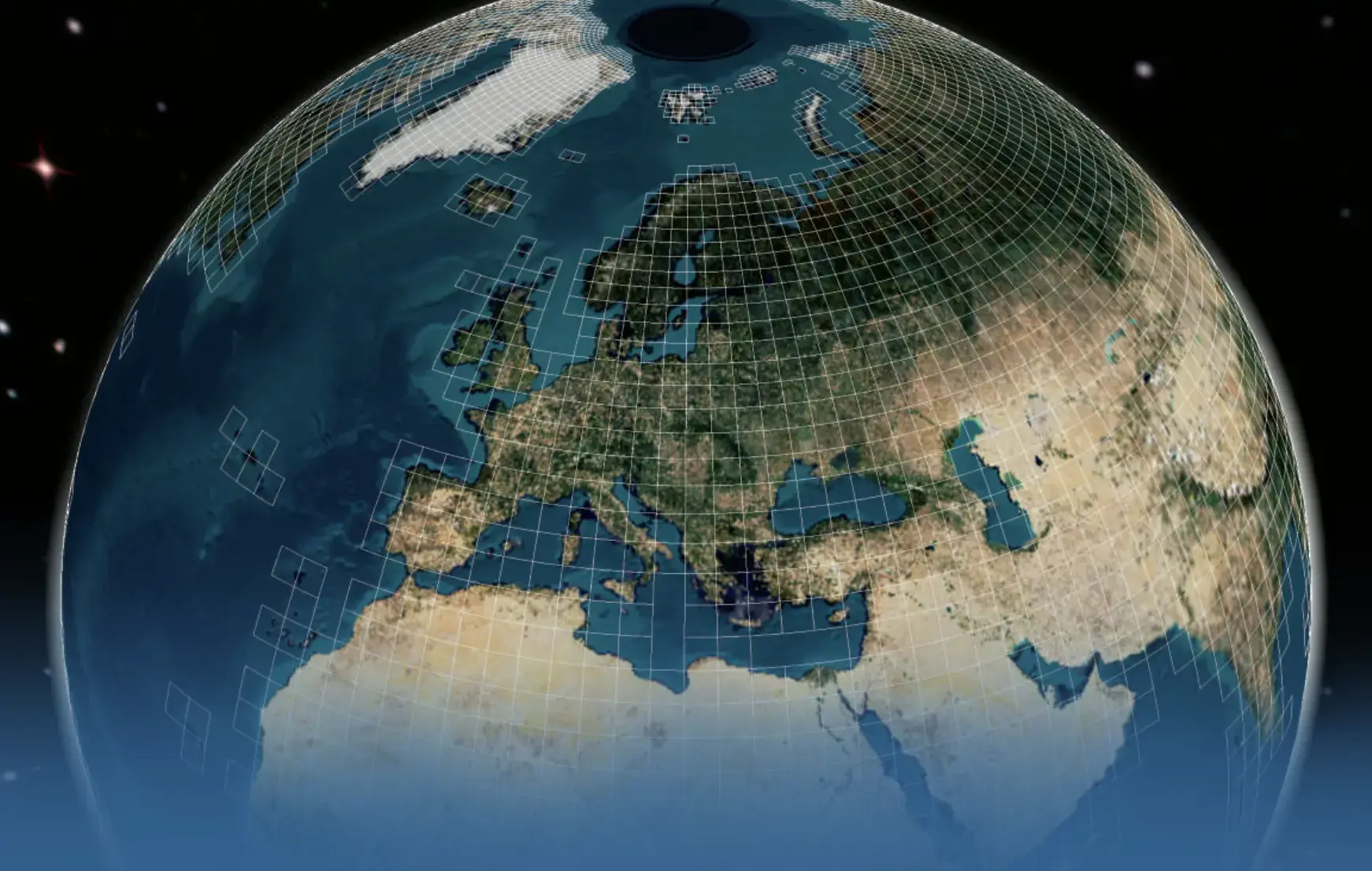
LuxCarta has applied its tuned artificial intelligence algorithms on a continuously updated supply of raw Sentinel-2 satellite imagery to create its Image Mosaic basemap.
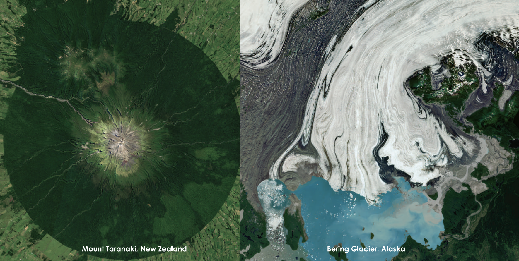
The result is a global mosaic, a seamless cloud-free* 10-meter resolution image of the entire Earth in bright and natural color. The image mosaic can be provided as files (e.g.. GeoTIFFs), streamed to integrated applications via XYZ Tiles protocol or rendered with LuxCarta DTM as CDB.
*Estimated at 99.8% cloud free
LuxCarta uses imagery provided by the European Space Agency (ESA) to produce its basemaps.
The Copernicus Sentinel-2 mission uses a constellation of two polar-orbiting satellites placed in the same sun-synchronous orbit, phased at 180° to each other.
Its 290 km swath width and high revisit rate makes it an ideal source for LuxCarta's basemaps and for monitoring changes on the Earth's surface.
Valuable Metadata per Geocell
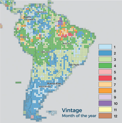
The data set is accompanied by a metadata grid in shapefile format that provides information per geocell, including:
Cloud : Percentage of possible residual clouds
Year : Year of the main date of the cell
Month : Month of the main date of the cell
Day : Day of the main date of the cell
Sensor : Type of main sensor in the cell

Why LuxCarta's Image Mosaic?
- 10m global landmass availability
- Ease of use - download only the area you require
- Unparalleled accuracy, color balancing and realism
- Scheduled updates (semi-annually)
- Flexible licensing options
- Data options : raw files, streaming or 3D files
- Created in the cloud : available through the cloud with BrightEarth on Demand
Technical Specifications
- Format: 8-bit, GeoTIFF, JPEG2000, ECW;
- other formats available
- Streaming: files (i.e., GeoTIFFS, COGS, ECW, JP2) streamed to integrated applications via XYZ Tiles protocol or rendered with BrightEarth DM as CDB
- Projection: Geodetic*
- Datum: WGS84
- Resolution: 10m spatial resolution
- Absolute positional accuracy: sub pixel**
- Imagery source: Sentinel-2
- Vintage: Current year with possible older imagery for cloud removal
*Only projection supported through online delivery; UTM and other coordinate systems available upon request
**Absolute positional accuracy of 5-8m (CE90)
