
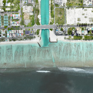
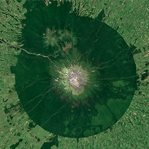
Scroll through the archives of leading satellite imagery providers


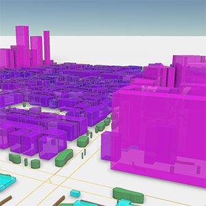
Vectorial GIS Data
BrightEarth transforms key landscape elements into 3D vectors—buildings, roads, vegetation, and walls. Download in standard GIS formats (.shp, .geojson, .tif, .kml) for seamless integration into your geospatial workflows.
Vectorial GIS Data
BrightEarth transforms key landscape elements into 3D vectors—buildings, roads, vegetation, and walls. Download in standard GIS formats (.shp, .geojson, .tif, .kml) for seamless integration into your geospatial workflows.
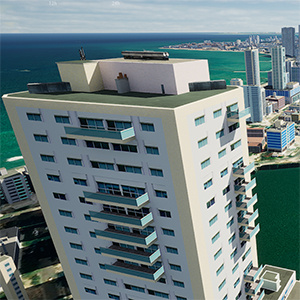
Augmented Buildings
Elevate realism with procedurally textured buildings featuring added details such as chimneys and balconies. Delivered in 3D Tiles format, these models integrate effortlessly with CesiumJS, popular game engines, and 3D GIS platforms
Augmented Buildings
Elevate realism with procedurally textured buildings featuring added details such as chimneys and balconies. Delivered in 3D Tiles format, these models integrate effortlessly with CesiumJS, popular game engines, and 3D GIS platforms
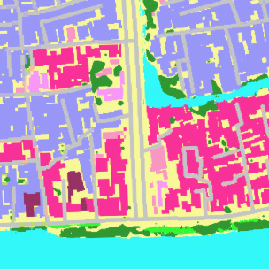
HD Land Use
Generate an 18‐class Land Use and Land Cover (LULC) dataset in GeoTIFF format at 50 cm resolution. Ideal for projects requiring high‐precision land classification.
HD Land Use
Generate an 18‐class Land Use and Land Cover (LULC) dataset in GeoTIFF format at 50 cm resolution. Ideal for projects requiring high‐precision land classification.
HD Satellite Imagery (available soon)
Download the orthorectified satellite imagery at 50cm resolution used for BrightEarth extractions, allowing offline use on the same image reference with background layer usage rights, at competitive rates aligned with provider platforms.
HD Satellite Imagery (available soon)
Download the orthorectified satellite imagery at 50cm resolution used for BrightEarth extractions, allowing offline use on the same image reference with background layer usage rights, at competitive rates aligned with provider platforms.
Global Imagery 10m
Our global mosaic is seamlessly assembled from harmonized Sentinel-2 images, featuring an advanced cloud removal process and radiometric adjustment for a smooth, gap-free result
Global Imagery 10m
Our global mosaic is seamlessly assembled from harmonized Sentinel-2 images, featuring an advanced cloud removal process and radiometric adjustment for a smooth, gap-free result
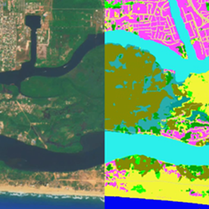
Global Land Use/Land Cover 10m
Directly derived from the global mosaic and perfectly aligned, this classification segments each pixel into 14 classes, delivering an unparalleled, high-accuracy baseline mapping solution.
Global Land Use/Land Cover 10m
Directly derived from the global mosaic and perfectly aligned, this classification segments each pixel into 14 classes, delivering an unparalleled, high-accuracy baseline mapping solution.
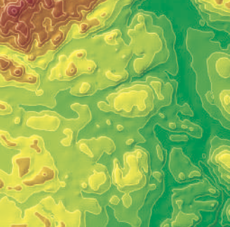
Global DTM 10m
Integrating the best global elevation data sources, our DTM is generated by removing vegetation and buildings, leveraging insights from our Global Land Use/Land Cover dataset.
Global DTM 10m
Integrating the best global elevation data sources, our DTM is generated by removing vegetation and buildings, leveraging insights from our Global Land Use/Land Cover dataset.